

GARDEN ROUTE | KAROO NEWS - A cut-off low developing off the west coast tomorrow (Friday 26 November 2021), will influence the intensification of a surface trough over western parts of the country.
This will result in strong to gale force winds over the western and central parts of the country as well as isolated to scattered showers and thundershowers. However, widespread rain showers are expected along the south coast and adjacent interior of the Western Cape.
The cut-off low will move over the southern parts of the country on Saturday (27 November 2021), maintaining a strong to gale force wind with rain and showers over the southern and central parts of the country. Towards Sunday, the system will weaken as it begins to move away from the country, with showers and thundershowers persisting over the central to eastern parts of the country.
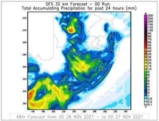 Figure 1: Total Precipitation for 24hrs (mm) for Friday 26 November 2021 as projected by GFS.
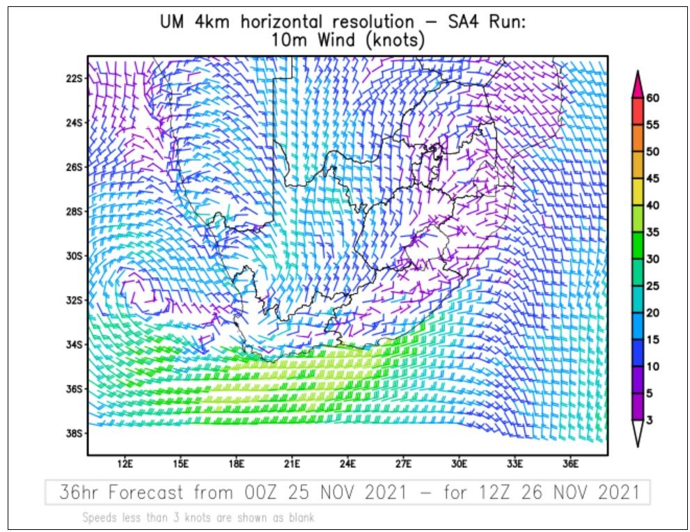 Figure 2 & 3: Winds on Friday (26 November 2021), at left and Saturday (27 November 2021), at right. Source: Unified Model.
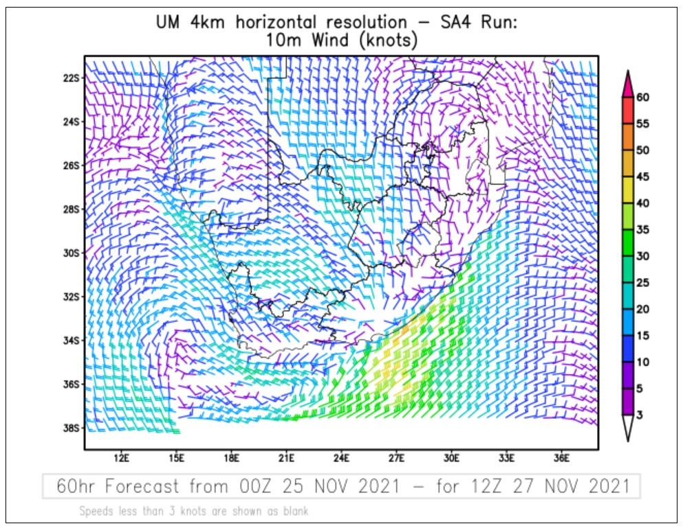 Figure 2 & 3: Winds on Friday (26 November 2021), at left and Saturday (27 November 2021), at right. Source: Unified Model.
The winds will remain strong over the western and central interior at 40 to 50 km/h on Friday and Saturday, with gale force to strong gale force winds along the south coast on Friday, spreading to the south-east coast by Saturday afternoon.
The South African Weather Service has issued the following WARNINGS associated with this system:
IMPACT-BASED WARNINGS:
A. Orange level 8 Warning for COASTAL WINDS resulting in disruption to craft in small harbours is expected between Table Bay and East London.
B. Yellow level 2 warning for WAVES resulting in difficulty in navigation at sea between Table Bay and Plettenberg Bay.
C. Yellow level 2 warning for FLOODING resulting in localised flooding of susceptible roads, low-lying areas and bridges expected along the south coast of the Western Cape.
D. Yellow level 2 warning for SEVERE THUNDERSTORMS resulting in localised damage to infrastructure, settlements (informal), property, vehicles, livelihood and livestock is expected over the eastern parts of the Northern Cape, the western parts of the North-West and Free State Provinces, and the central and eastern interior of the Western Cape.
E. Yellow level 4 warning for INTERIOR WINDS resulting in structural damage is expected over the Northern Cape, Western Cape western parts of the North-West Province, Free State and the Eastern Cape.
The South African Weather Service (SAWS) will continue to monitor further developments relating to this weather system and will issue timely updates in this regard. Furthermore, the public are urged and encouraged to regularly follow the weather forecasts issued by SAWS on television and different radio stations.
Updated information in this regard will regularly be available at www.weathersa.co.za as well as via the SA Weather Service Twitter account @SAWeatherService and on the Weather Smart App.
'We bring you the latest Garden Route, Hessequa, Karoo news'


