GARDEN ROUTE | KAROO NEWS - In the latest update from the South African Weather Service, a cut-off low is situated south-west of South Africa.
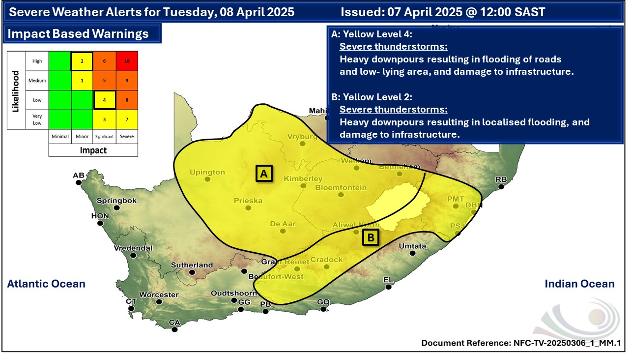
Impact based warnings:
Yellow Level 4: Severe thunderstorms leading to damage or loss infrastructure, settlements (formal and informal), property, vehicles livelihood and livestock over the Northern Cape, Western parts of the North West and the Free State.
Yellow level 2: Severe thunderstorms leading to flooding of susceptible roads, low-lying areas and bridges as well as localised damage to settlements are expected over the southern parts of KwaZulu Natal and the northern and extreme western parts of the Eastern Cape.
Regional weather forecast for Tuesday, 8 March:
Western Cape:
Morning and evening fog patches along the west and south-west coast, otherwise cloudy and cool with scattered showers and thundershowers but widespread over the South coast and adjacent interior. The wind along the coast will be light north-westerly but moderate to fresh westerly to south-westerly along the south coast.
The expected UVB sunburn index: Moderate
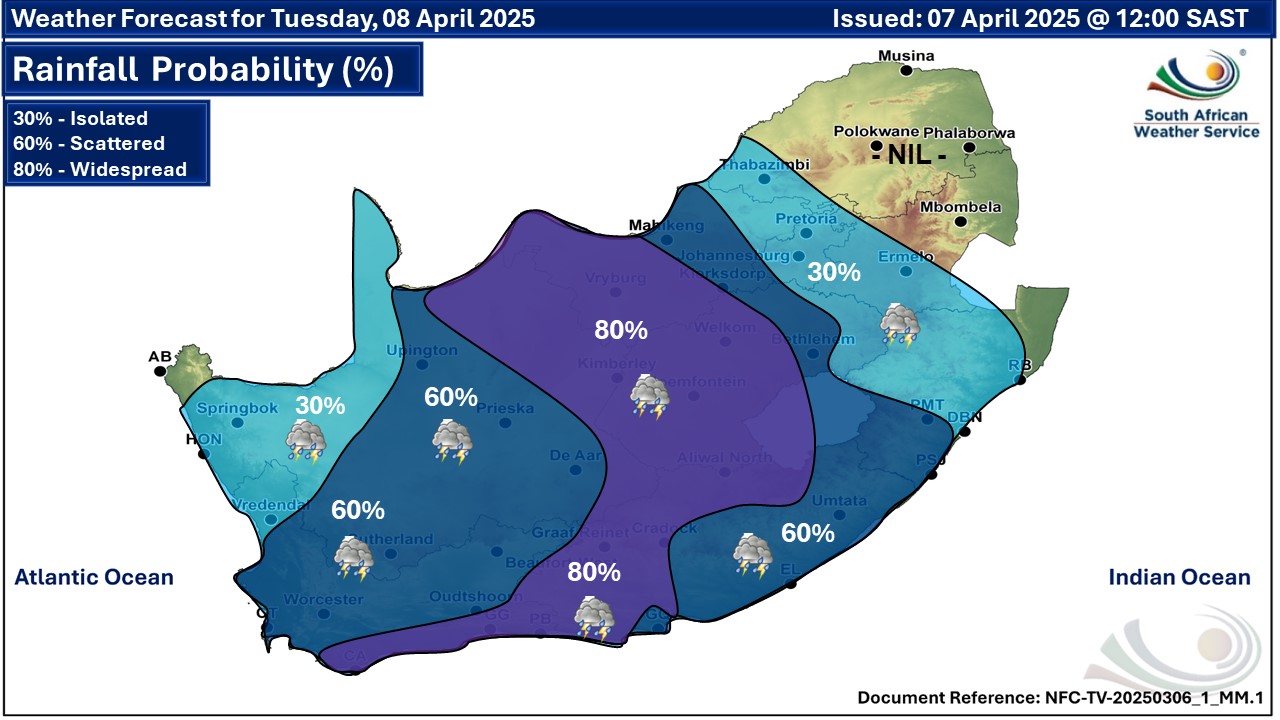
Western half of the Eastern Cape
Cloudy and cool to warm with widespread showers and thundershowers but scattered in the south-east. The wind along the coast will be light to moderate north-easterly east of Cape St Francis early morning, otherwise moderate to fresh south-westerly, reaching strong in places from the afternoon.
Eastern half of the Eastern Cape
Morning fog in places, otherwise cloudy and warm with scattered showers and thundershowers, but widespread in the north where it will be cool. The wind along the coast will be Light to moderate north-easterly, becoming southwesterly in the south from late morning.

‘We bring you the latest Garden Route, Hessequa, Karoo news’