



GARDEN ROUTE | KAROO NEWS - After a warm start to the week in parts of the Western Cape, temperatures are expected to drop sharply along the Garden Route as cooler, wetter conditions move in for Saturday.
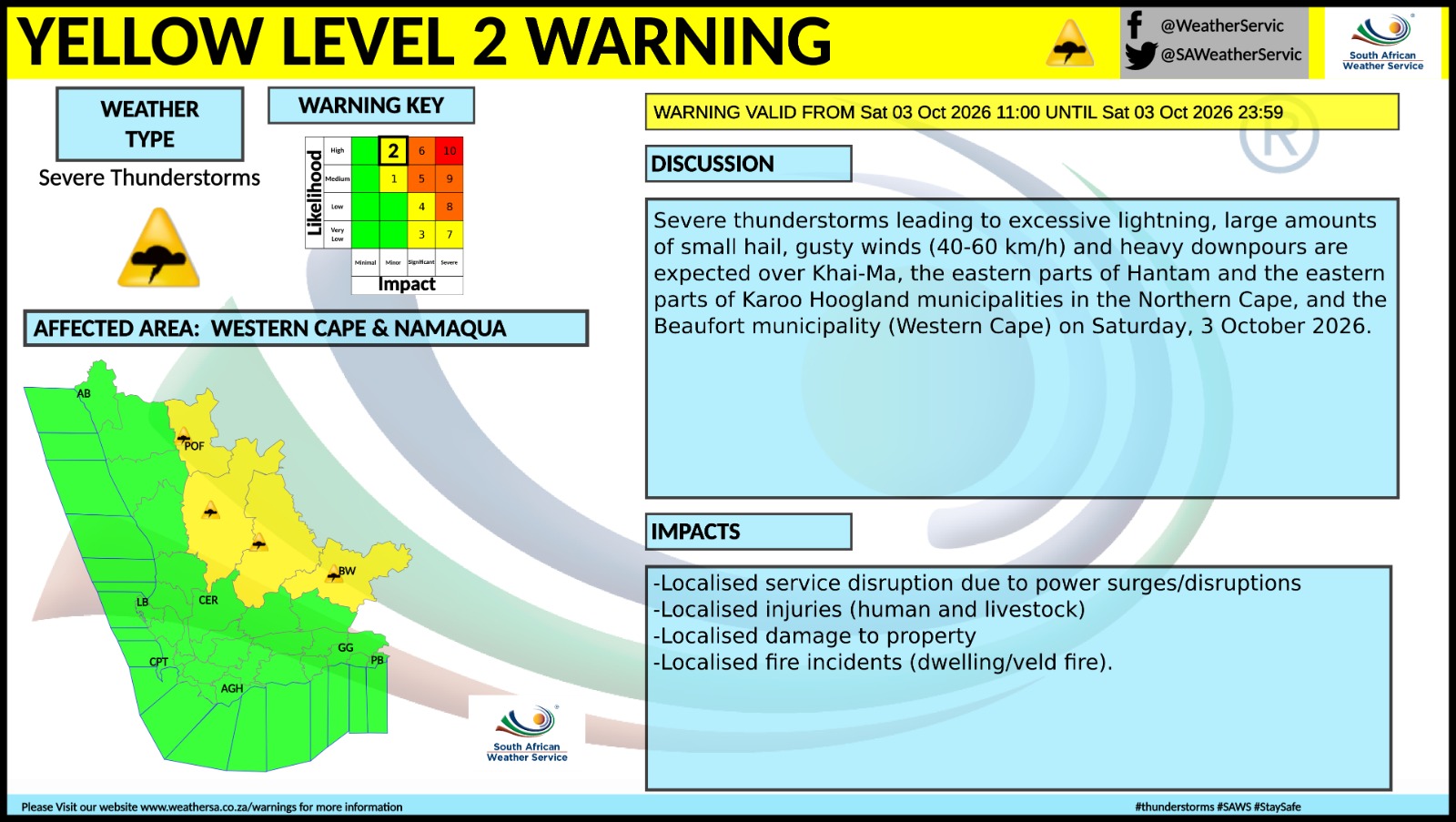
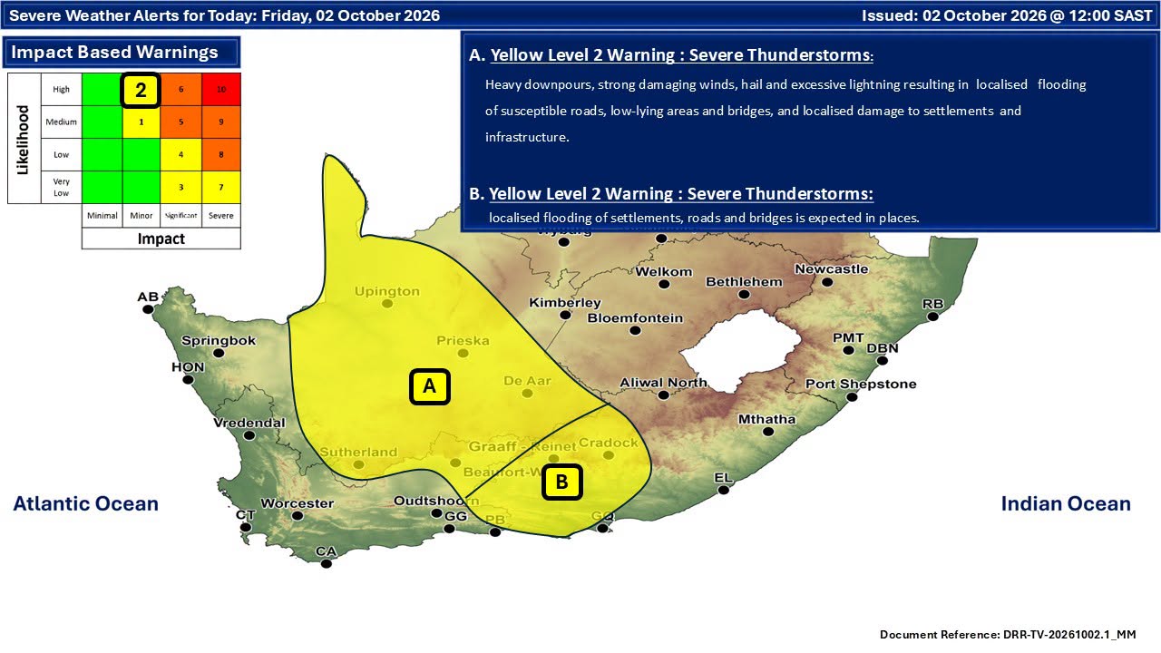
The biggest concern, however, is further inland, where the South African Weather Service (SAWS) has issued a Yellow Level 2 warning for severe thunderstorms valid from 11:00 until midnight on Saturday, 3 October.
According to the warning, severe thunderstorms could bring excessive lightning, large amounts of small hail, heavy downpours and wind gusts of between 40 and 60km/h.
The affected areas include Khai-Ma, the eastern parts of Hantam and Karoo Hoogland municipalities in the Northern Cape, and Beaufort Municipality in the Western Cape.
Possible impacts include localised power disruptions, injuries to people and livestock, property damage and isolated dwelling or veld fires.
Garden Route turns wet and cool
Along the Garden Route, the weekend outlook is less severe but decidedly wet.
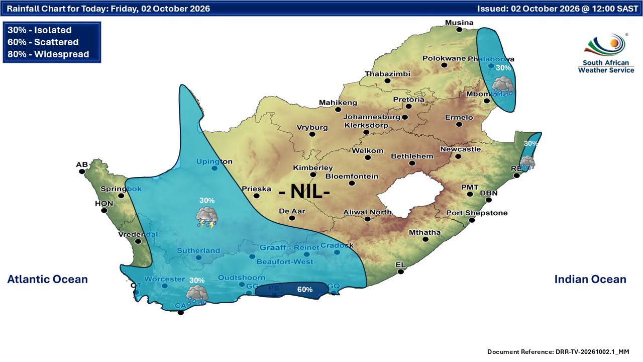
Current forecasts indicate that Saturday will be the wetter and cooler day, particularly towards the eastern Garden Route.
George is expected to reach only around 16°C on Saturday, with rain possible, before conditions become milder on Sunday, when temperatures could climb to about 21°C.
Further east, the prospect of rain becomes more pronounced.
Knysna is forecast to remain cool on Saturday, with temperatures around 16°C, while current forecasts indicate several millimetres of rain. Sunday should bring some improvement, although a chance of light rain remains.
Mossel Bay is similarly expected to be cool on Saturday, with rain possible, followed by somewhat drier conditions on Sunday.
The outlook for Plettenberg Bay is particularly wet, with one current forecast indicating heavy rain on Saturday and considerably lighter rain on Sunday. Another forecast also puts the probability of rain at more than 60% on both days.
This means residents and visitors travelling along the Garden Route should be prepared for wet roads, reduced visibility and chilly conditions on Saturday, particularly between George, Knysna and Plettenberg Bay.
Karoo faces thunderstorms and a sharp temperature drop
The weather story changes considerably inland.
Beaufort West is among the areas expected to be affected by Saturday's severe-thunderstorm warning. Forecast information points to a significant temperature drop, with conditions considerably cooler than earlier in the week and rain or thunderstorms possible.
The wider Karoo could therefore experience a combination of heavy downpours, lightning, hail and strong wind, with conditions varying considerably from one locality to another.
Oudtshoorn is also expected to turn wet and cool on Saturday, with a forecast high of around 15°C and approximately 9mm of rain, before temperatures recover to about 22°C on Sunday under partly cloudy conditions.
The contrast with the beginning of the week is notable, with the interior having experienced considerably warmer conditions before the arrival of the cooler system.
Saturday looks like the day to watch
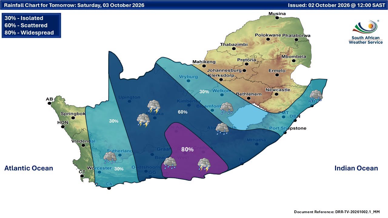
The latest forecasts suggest that Saturday will be the main weather day to watch.
For the Garden Route, that means rain and cooler temperatures, with the wettest conditions currently expected towards the eastern section.
For the Karoo, the situation is more potentially disruptive, with the SAWS Yellow Level 2 warning specifically highlighting the possibility of severe thunderstorms.
Anyone travelling through the affected Karoo areas should be prepared for rapidly changing conditions and should avoid crossing flooded low-water bridges or streams.
Thunderstorms also bring the risk of lightning strikes, and people outdoors should move indoors when thunder is heard.
Sunday brings some improvement
Conditions are expected to ease in many parts of the Garden Route on Sunday, although cloud and isolated rain could linger, particularly along the coast.
George is forecast to become warmer at around 21°C, while Knysna could reach about 22°C. Mossel Bay should remain cooler at around 18°C.
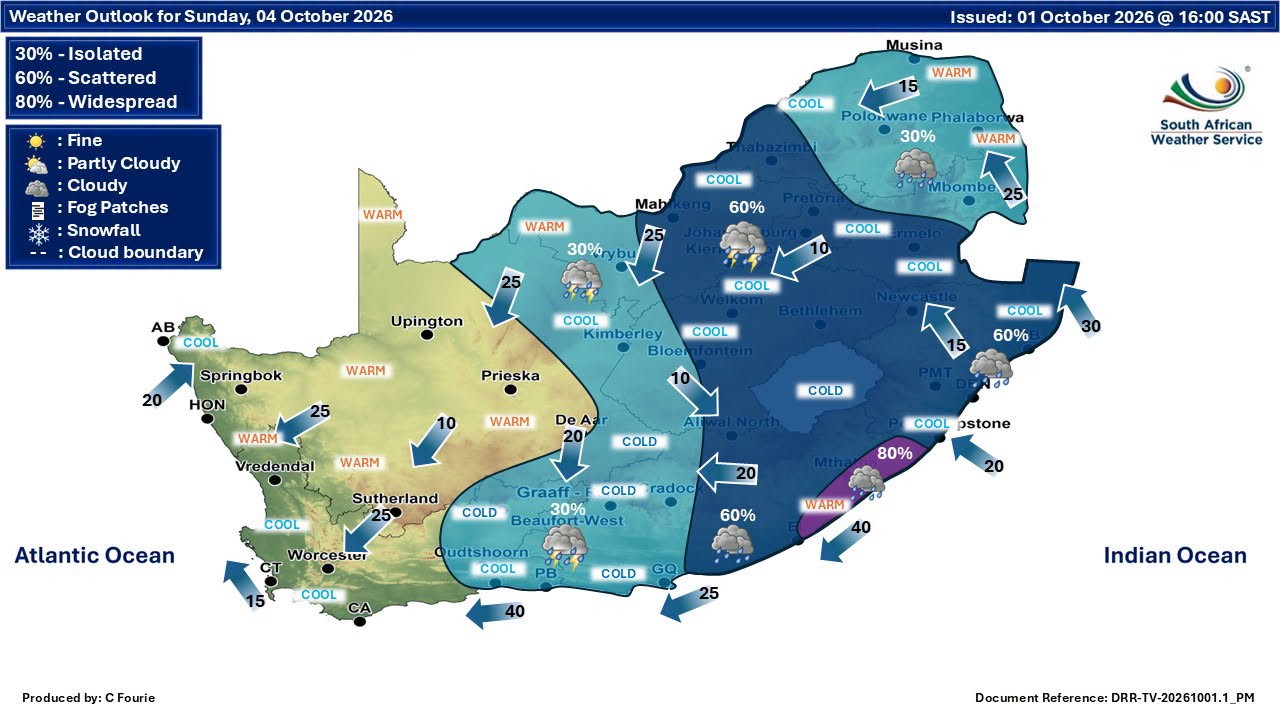
Oudtshoorn should also see a significant improvement, with temperatures potentially reaching 22°C after Saturday's cold and wet conditions.
The Karoo may not escape the unsettled weather completely, however, with showers and thunderstorms still possible in parts of the interior on Sunday.
A weekend of contrasts
The first weekend of October is therefore likely to bring two very different weather experiences across the region.
The Garden Route can expect a chilly and wet start to the weekend, particularly on Saturday, while the Karoo faces the possibility of more disruptive thunderstorms, including lightning, hail, heavy rain and strong winds in the areas covered by the Yellow Level 2 warning.
Forecasts can still change, particularly regarding the precise location and timing of thunderstorms and rainfall. SAWS notes that forecasts become more accurate closer to the event, making its latest warnings and updates the most important source to monitor as the weekend progresses.
For anyone planning an outdoor weekend, Saturday is the day to keep a particularly close eye on the skies.
Source: South African Weather Service and current regional forecast data.
‘We bring you the latest Garden Route, Hessequa, Karoo news’